
Trail Description

NOTE: Mileage varies greatly depending on vehicle clearance for this hike!
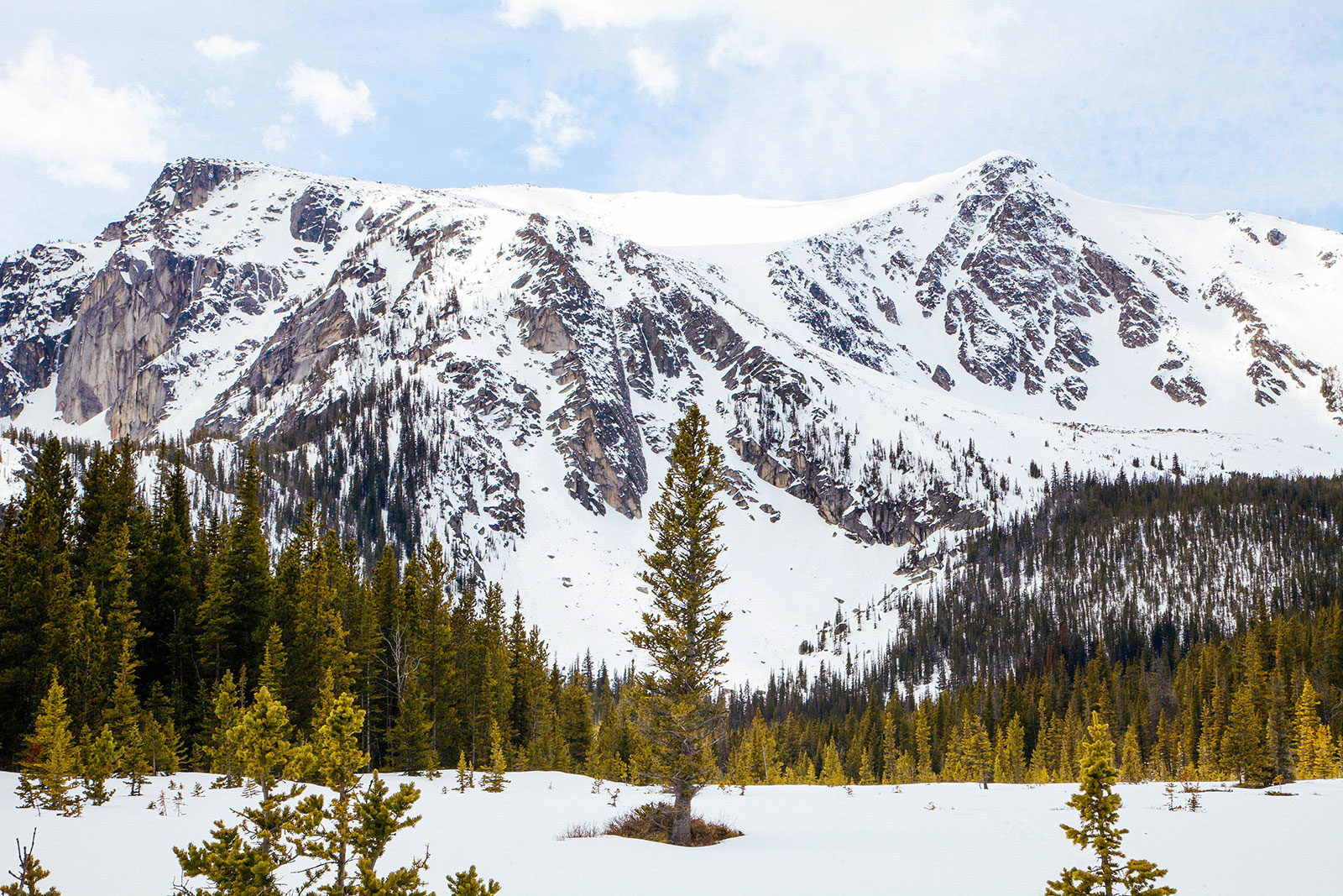
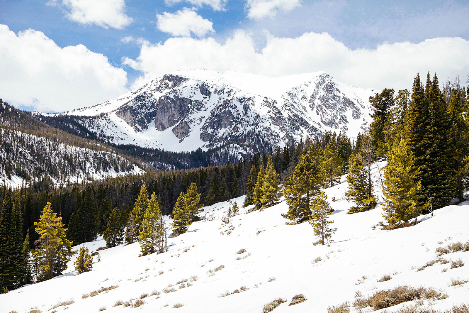
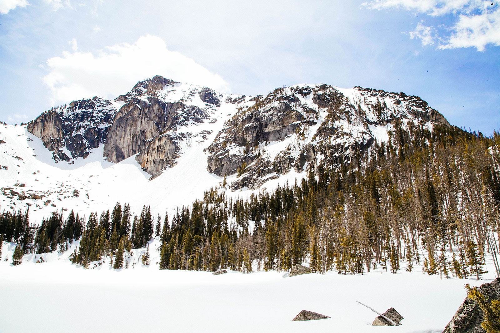
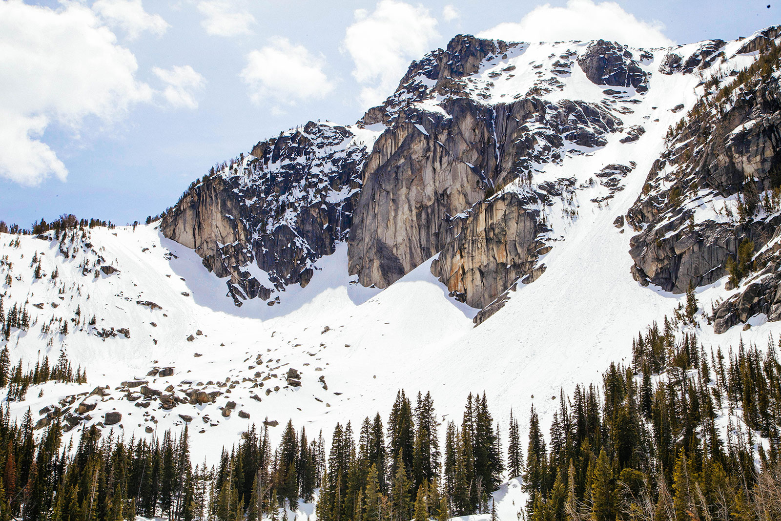
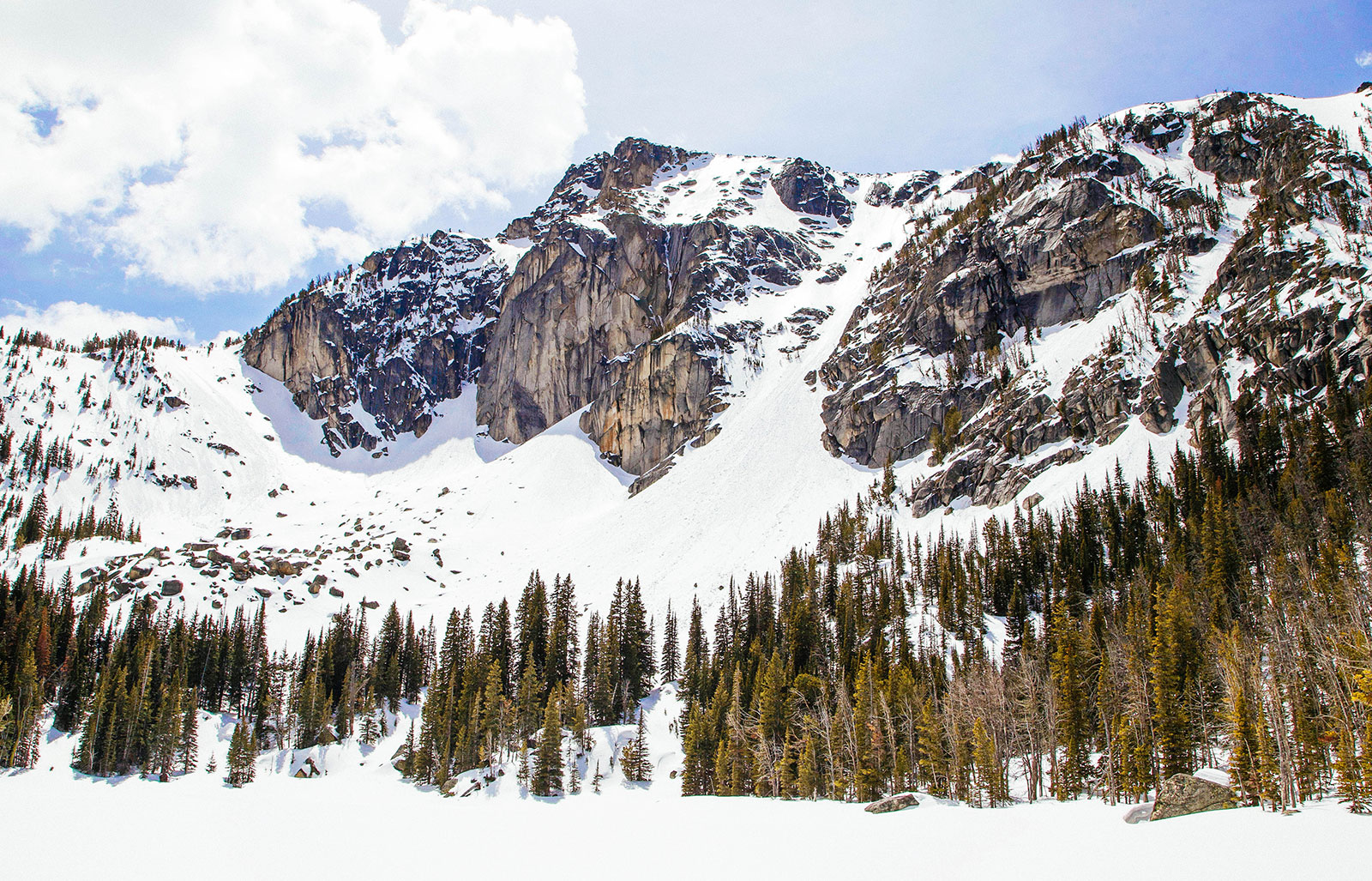
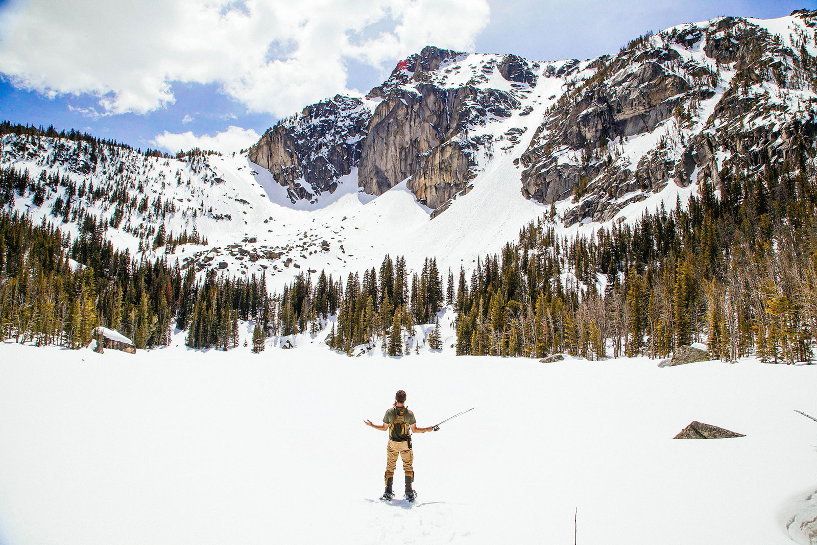
Upper Mason Lake in the Tobacco Root Mountains is a great hike featuring views of Hollow Top Mountain and unique cliff formations. We ended up parking where the lower clearance vehicle trailhead coordinates are. Hiking the road up to Cataract Lake is fairly steep but only about a mile or so. This lake seemed to be pretty popular as we saw several groups of people camped out and fishing along its shoreline. We continued on up the road for another mile and half or so. We did end up taking a shortcut to bushwack up Cataract Creek and connected back with the trail up to Mason Lake. You can follow the road to our high clearance coordinates to stay on an actual trail. If you take the road up, you will see a great view of Hollow Top Mountain. We didn’t catch our first view until a while later on the trail because of our shortcut. The hiking is fairly flat and easy once you are on the actual trail. There are a few open meadow views of the mountains along the way. You will approach Lower Mason Lake which is shallow and marshy. Our GPS trail took us up a very steep cliffside, which we do not recommend. We recommend following a gully up to Upper Mason Lake. This is the steepest ascent, but once up there you will have breathtaking views of Hollow Top Mountain’s cliffs.