Trail Description

NOTE: The last section of this hike is trailless, make sure you are comfortable with that first.
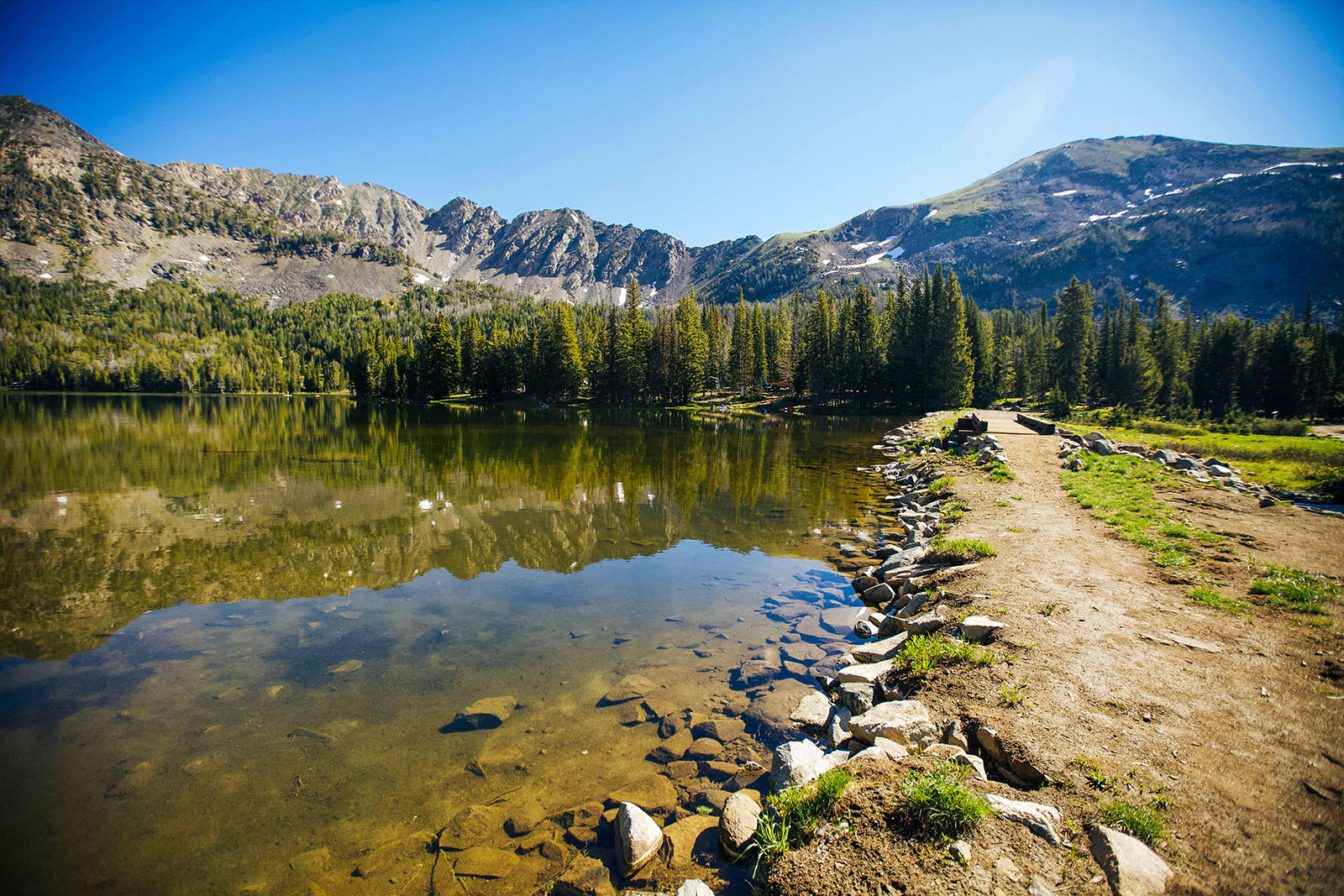
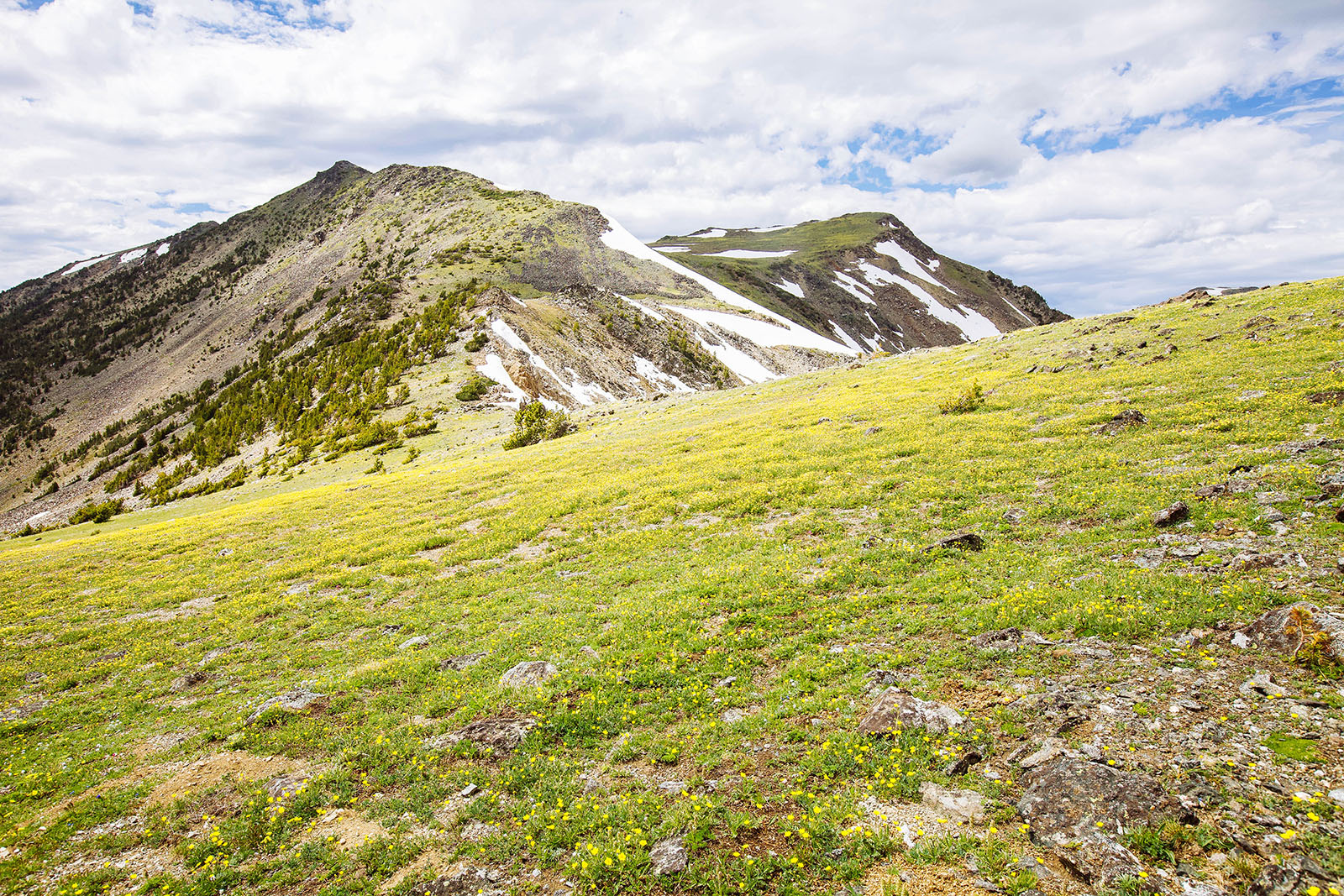
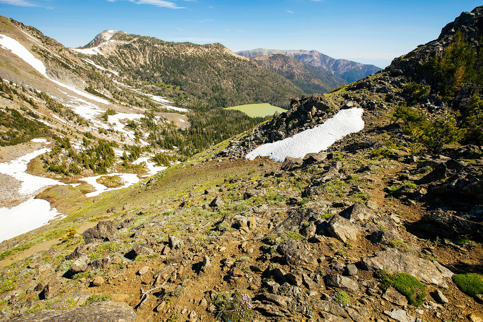
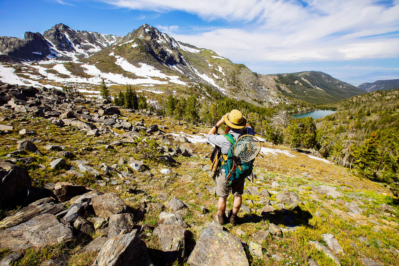
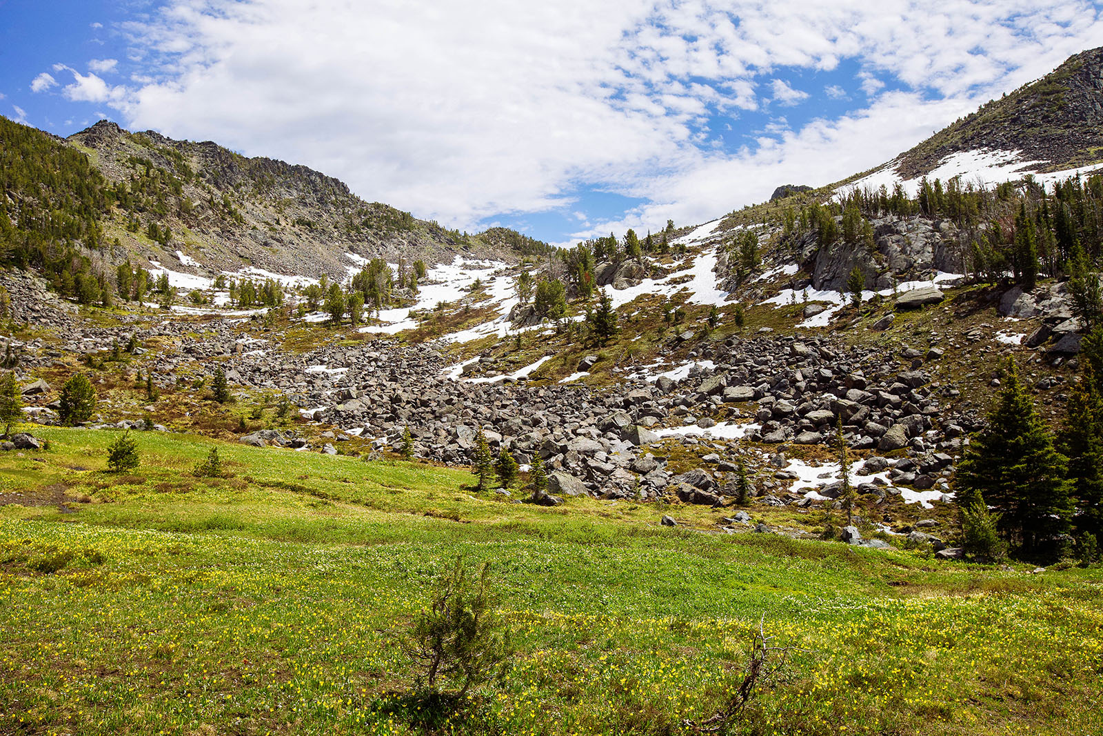
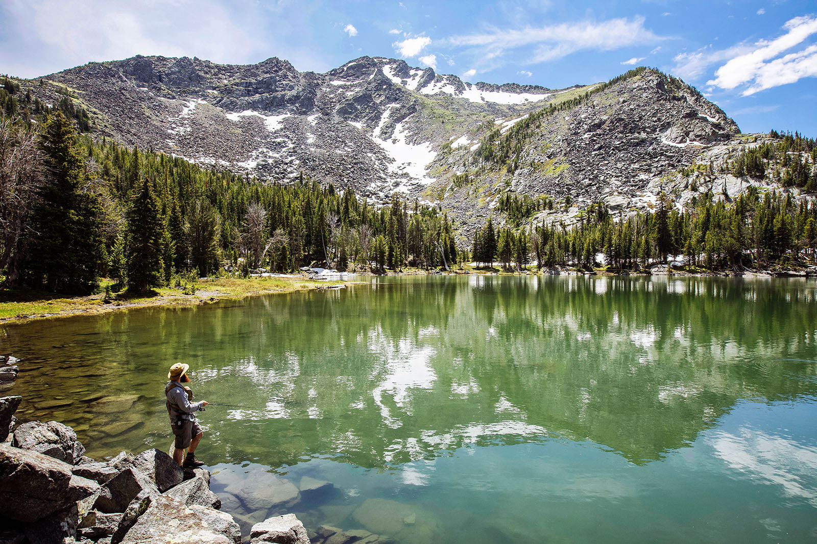
Thompson Reservoir in the Tobacco Root Mountains is a wonderful short hike. The trail heads out from the parking lot of the very alluring Branham Lakes. These lakes are gorgeous on their own and seem to be a popular location to hang out and camp. You cross a pathway at the South end of the lake and meander several switchbacks through the forest. After a half-mile, the forest opens up into a field with fantastic views of the surrounding mountain and valley you will be climbing up. The hiking is fairly easy with a gradual ascent of a quarter-mile. You soon hit a rocky valley wall and climb up through a very switchback trail. This is where you gain the most ascent (which isn’t really that long). Once you hit the mountain pass ridgeline, you are treated to some of the most incredible views of the Tobacco Root Mountains. Any direction you look features an impressive view. From the mountain pass, you can actually see Thompson Reservoir (looking west, NOT Bell Lake which is green). There is no designated trail, but it should be fairly straightforward that you would head west descending down towards the lake. There are a few cairns along the way as you follow South Fork Indian Creek down to Thompson Reservoir. The reservoir has incredible views and a good amount of shortline to explore. Just remember that you still have to re-ascend from the way you came down!
Looking to add on another part to this day hike? Consider combining this with Gneiss Lake.