Trail Description

The trail we took to Warren Lake in the Anaconda-Pintler Wilderness starts from the West Fork Fishtrap Trailhead.
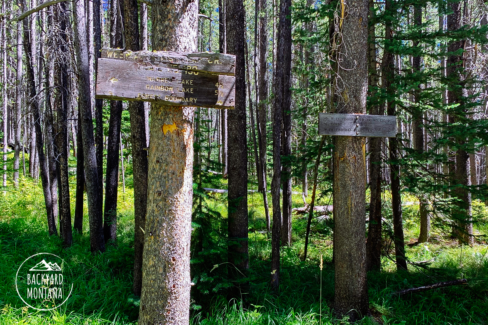
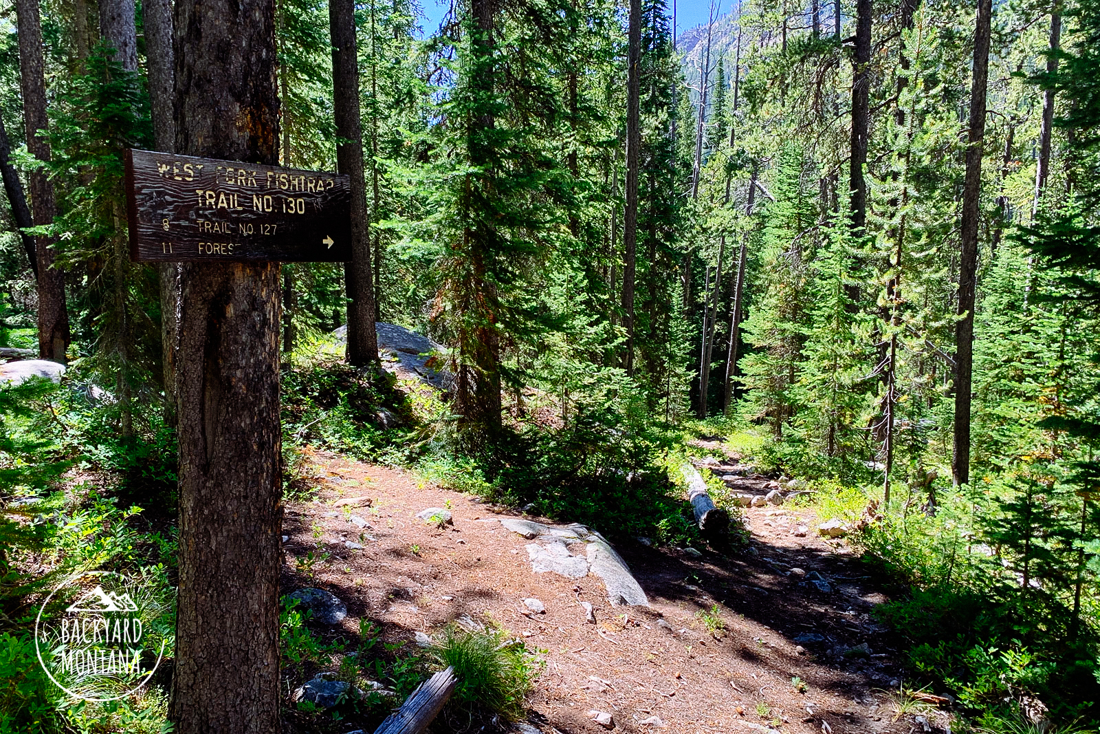
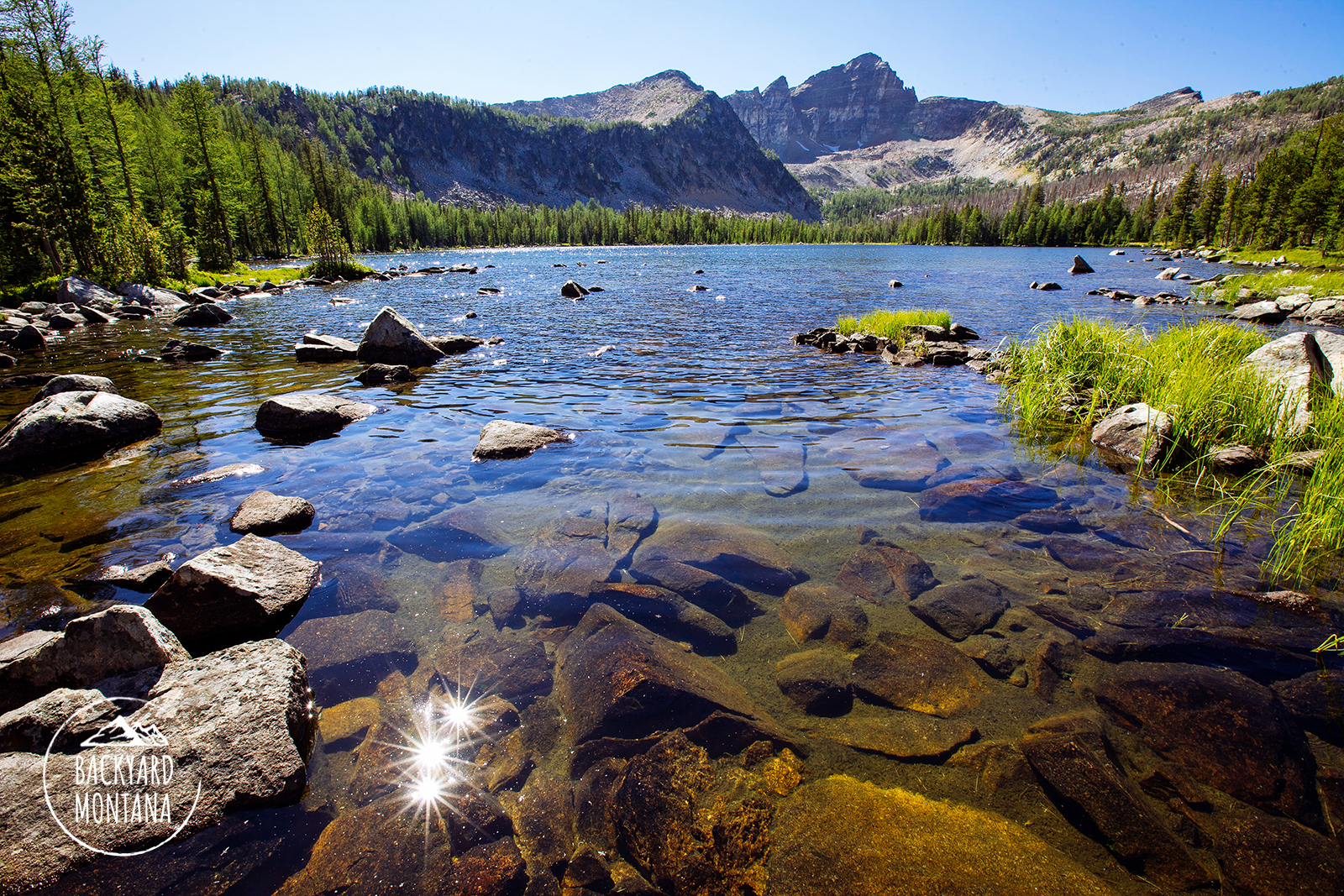
The hike to Warren Lake starts out on relatively gradual and easy terrain which passes by a lush field encompassing West Fork Fishtrap Creek. The majority of this trail is gradual which makes for quick miles to an experienced hiker. There are only two intersections, with marked signage (see image slideshow). There aren’t too many views during the hike, but you do pass through a lot of huckleberry bushes a few miles into the hike. We were lucky to catch them just as they were ripe. The trail picks up noticeable elevation after the second intersection. It is about 2 miles from the last intersection to the lake which can be steep and rocky at times. There are a couple of switchbacks heading up the ridge that goes on for about .25 miles. Once at the top you can see a short descent down to the lake’s edge. The views are beautiful from this lake and the sunrise hits the mountain backdrop perfectly. Surprisingly the mountain that is so prominent behind the lake is not Warren Mountain. It is an unnamed peak and Warren is behind it.
Looking to add to this hike? Consider continuing onto Cutaway Pass by reading our Warren Lake to Cutaway Pass hike.